Geo Map Optimisation
Overview
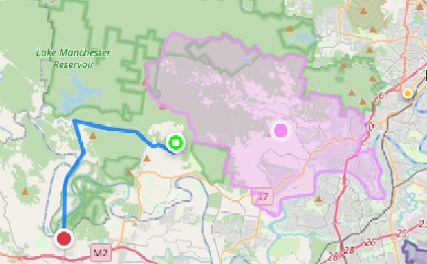
This solution presents one of the first approaches to finding road distance based on suburb coordinates in Brisbane, Australia. The goal is to find the closest polygon — representing a suburb — to a user's address. If the address is inside the polygon, the software detects it; otherwise, it identifies the closest polygon and finds the shortest path from the user's address coordinates to the nearest edge of that polygon.
This enables route finding for businesses that aim to identify the best services, facilities, and opportunities for people who reside in a particular suburb, or for those who want to find the closest suburb for their needs — providing a solution for determining the best branch or office for a user based on the road network.
Business Value
Nearest Service Detection
Finds the nearest office or service automatically, helping users — especially older individuals — quickly access the closest location without confusion.
Time & Travel Savings
Saves time and reduces travel effort by calculating the shortest route, avoiding unnecessary distance and heavy traffic.
User-Friendly Experience
Simple and intuitive, making it easy for all users including those less familiar with technology to navigate and make decisions confidently.
Maps & Visualisations
How It Works
- 1
User provides their address
- 2
Address is converted to geocodes (latitude, longitude)
- 3
System checks if the address is inside any polygon — if so, returns "inside" and ends
- 4
If not inside, for each polygon calculate using Shapely and Dijkstra's algorithm
- 5
Sort the results across all polygons
- 6
Depict the shortest path and destination on the map
Pipeline Diagram
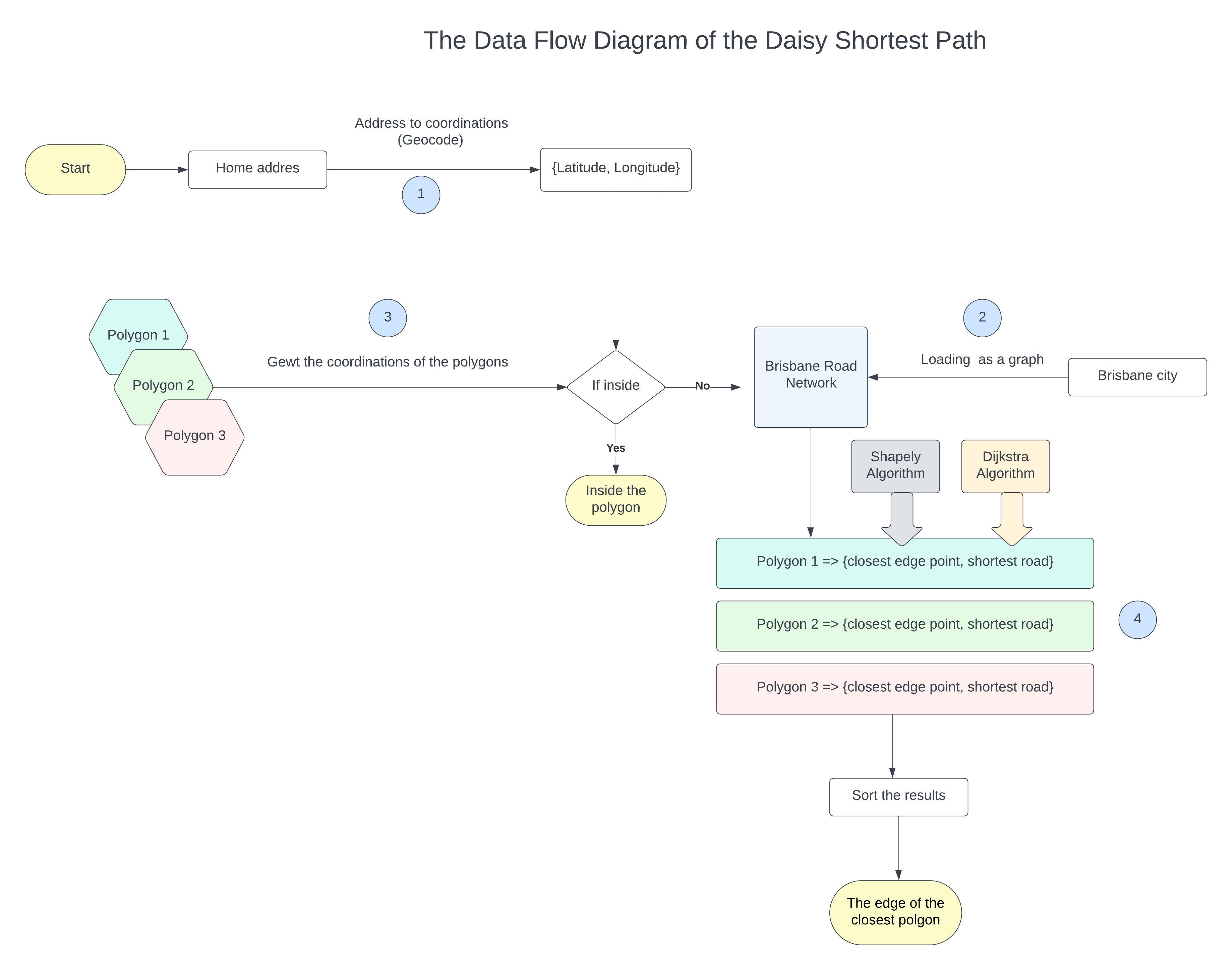
Click image to enlarge
Python Packages Used
Shapely / GeoMap
Handles geometric operations such as detecting whether a point lies inside a polygon and calculating distances to boundaries.
KML Parser
Reads and extracts suburb boundary data from KML files into usable formats.
JSON
Structures and stores geospatial data and intermediate results in a flexible, readable format.
Geocoder
Converts user addresses into geographic coordinates (latitude and longitude).
Haversine
Calculates the distance between two geographic points based on their coordinates.
GeoPandas
Manages, analyses, and visualises geospatial data efficiently in a tabular structure.
Interested in location-based optimisation or routing for your business?
Get in touch